Céad míle fáilte go Tourmakeady
Hill Walking in Tourmakeady:
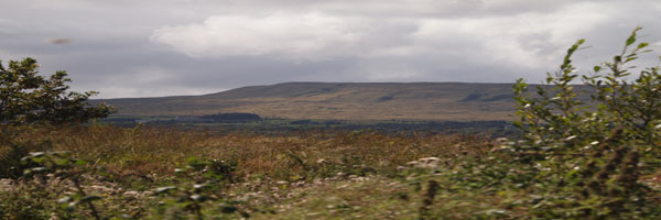
Tourmakeady is situated at the base of the Partry Mountains and along the western shore of Lough Mask. The scenery is outstanding and it is the perfect for an evening stroll, or for the more energetic hillwalker. The local tourism group organised the mapping of some walks in the area from Finney to Tourmakeady. The maps are drawn up by Joe McDermott.. Walking in the hills inevitably means walking over bog or peat. Bog is the Gaelic word meaning soft and every hill walker knows exactly what this means.
(There are copies of the maps on the following pages but original copies may be obtained from the local Tourism Office. While every care has been taken in compiling these maps, Tourmakeady Tourism Group, it's servants or agents, are not liable for any loss, injury damage or inconvenience sustained or caused as a result of using these guides.)
Walk Number 4 - The Killateeaun Walk:
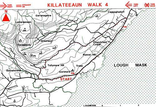
This walk is entirely on metalled road. This allows walkers who might be apprehensive about climbing the hills or walking in open country where navigation skills could be needed to enjoy the magnificent scenery without leaving the road for the wild mountain sides. The walker needs only to observe where the way markers lead at each road or track junction. The placename "Killateeaun" is a fine example of the Gaelic language adapted to a new form, the placename meaning the Weed of the Fairies.